
Lining Up Mystara IX
I’ve been working on lining up the world map with what we have so far. This leads naturally into Davania and the problems with latitude, and I think I’m starting to get a handle on all these.
But that’s for another day. Because today I want to share a sneak peek at what else I’ve been working on.
Revised World Map, Take One
In order to do this, I had to piece together a world map. So you can see here my current position thinking on placing Davania and Skothar, and indeed the latitude problem. (Of course it may well still change.)
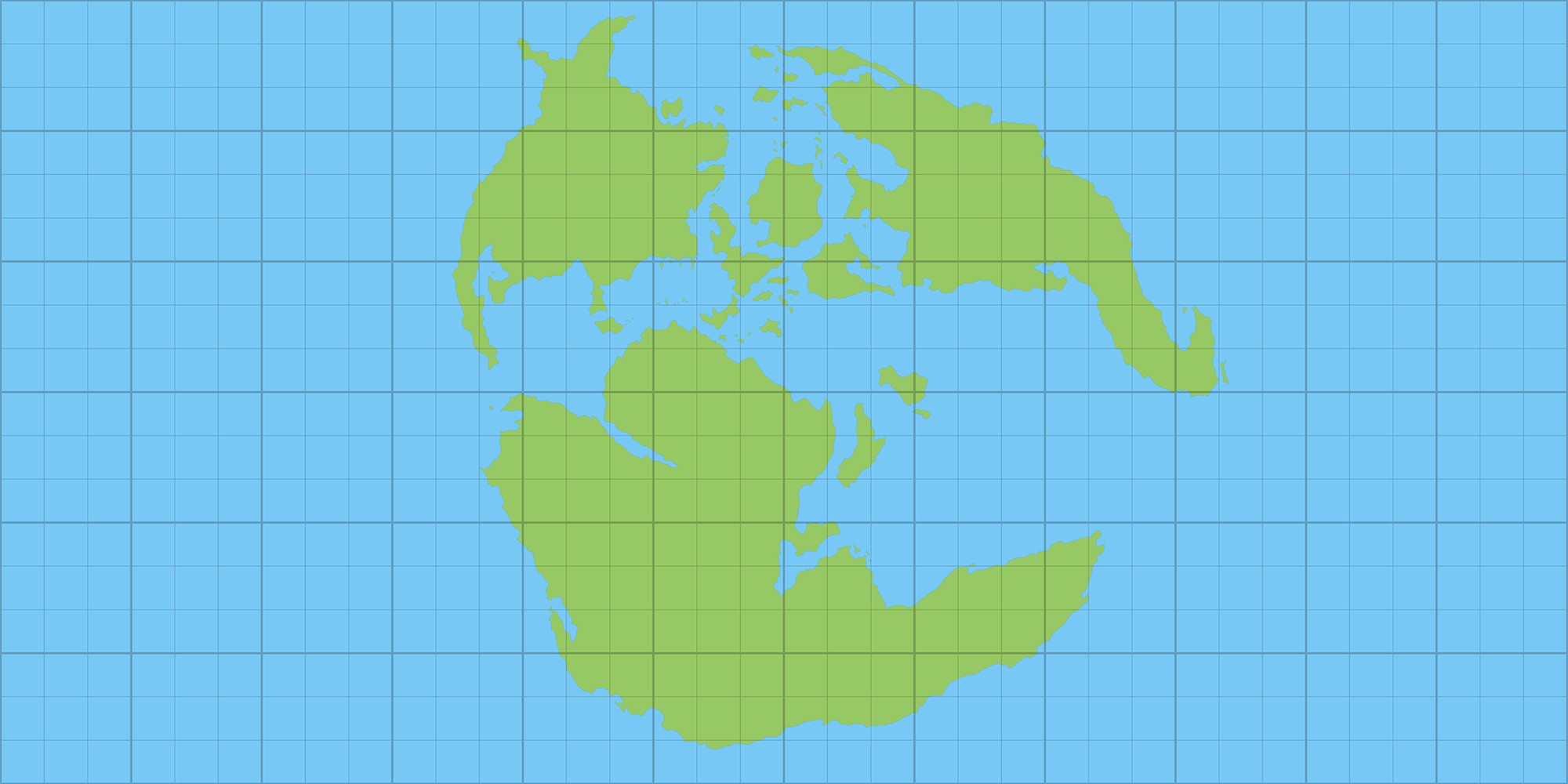
Note how large the Far End Ocean is — and this is not likely to change much. It takes up more than half of the world! Ripe for development…
But let’s get going! Now that we have a 2:1 ratio world map, it’s time to have some fun.
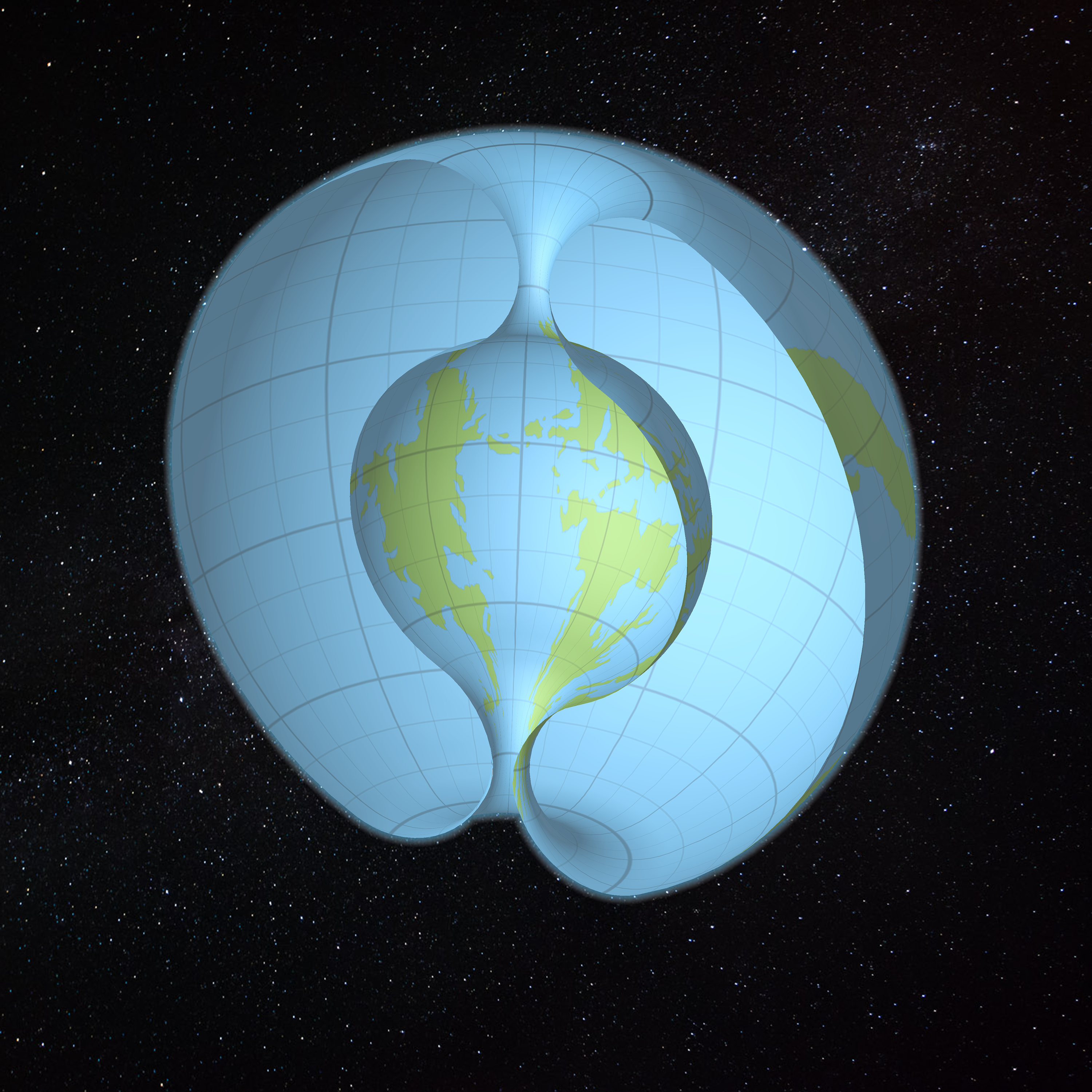
The World of Mystara?
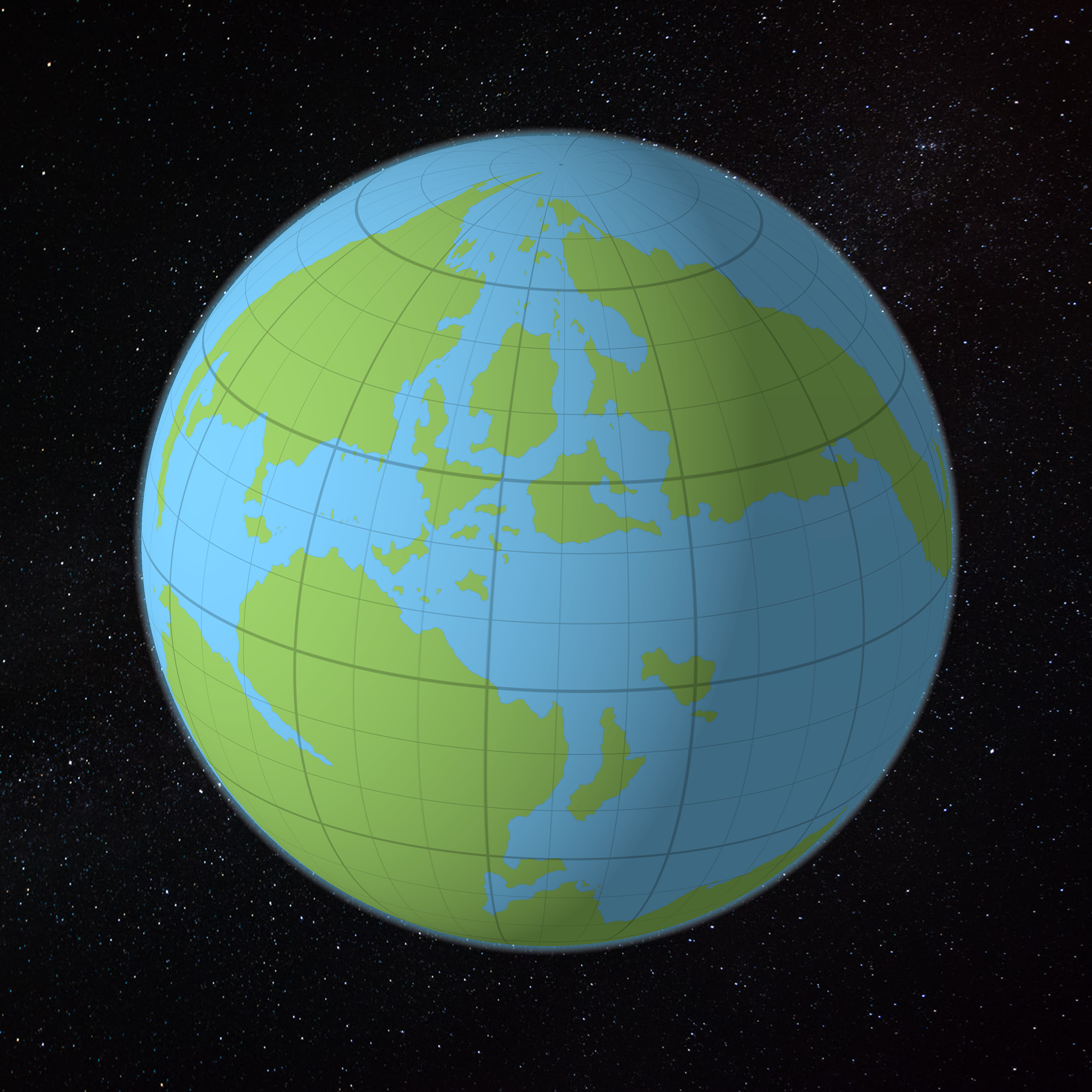
Here’s what happens when you apply the above map to a spheroid. Of course, we all know Mystara is not a simple ellipsoid, so it’s not going to look quite like this, but this is the basic idea.
Do you see the pinching at the north pole? Hyborea is all squashed and tiny, and the Pelatan Peninsula is more of a blob. These can be redrawn slightly to restore their familiar shapes, but their small size is unavoidable.
Thankfully, since Mystara has no poles, the distortion will be rather different from what we see here.
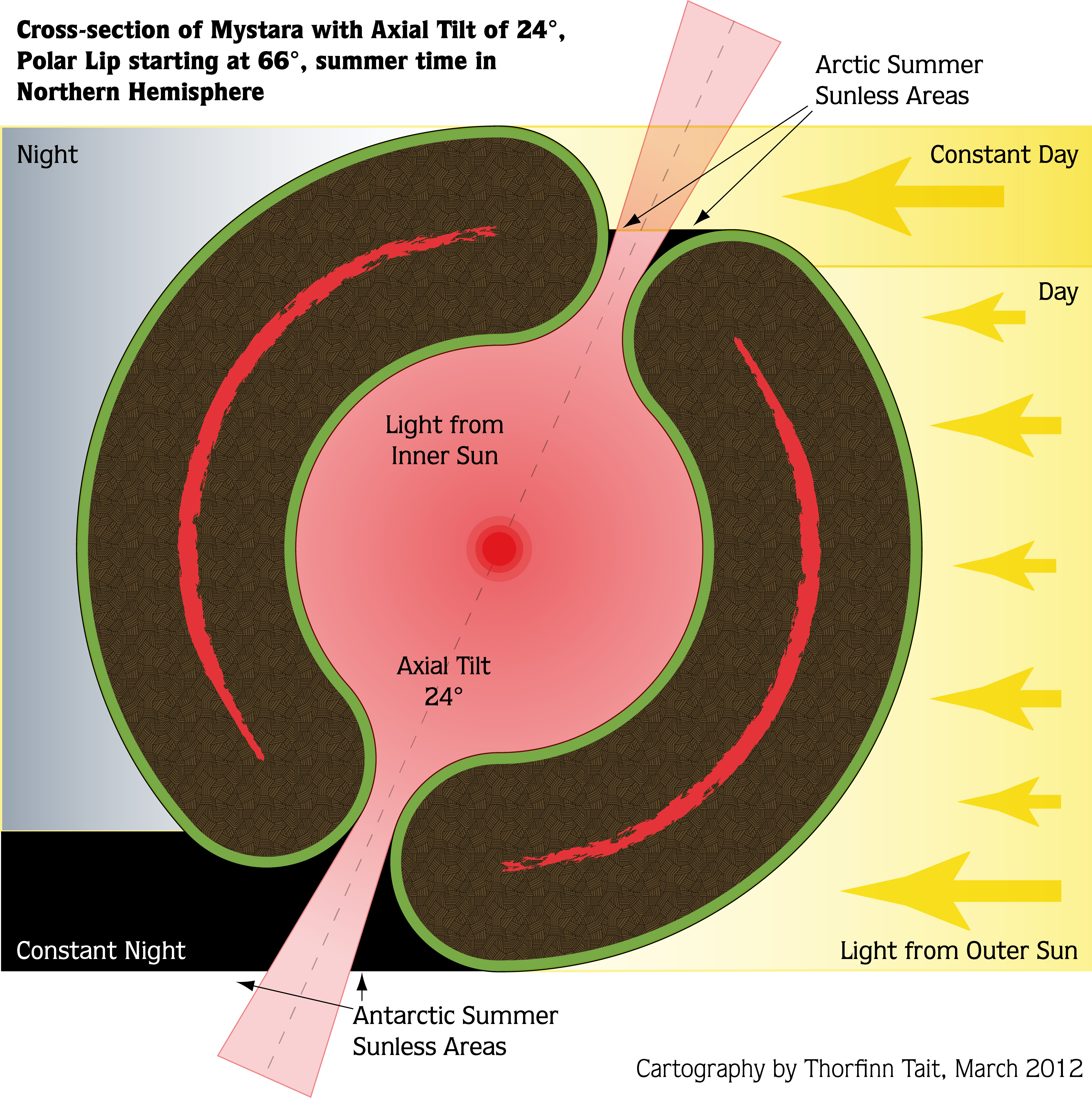
Back in 2012, I created some scale diagrams with my calculated world dimensions of the time. Take a look:

I don’t really remember the exact basis for these measurements, but I will need to revise the Outer World figures when I have everything locked down.
The axial tilt of 24º, combined with the polar openings beginning at the Arctic Circle, 66º, was an arbitrary decision that I’d like to stick with — unless there are any objections. Neither of these were detailed much in official sources; the tropics and Arctic and Antarctic Circles were shown on various maps, but without much consistency.
So what would this look like in 3D, with the preliminary world map applied?
The World of Mystara!
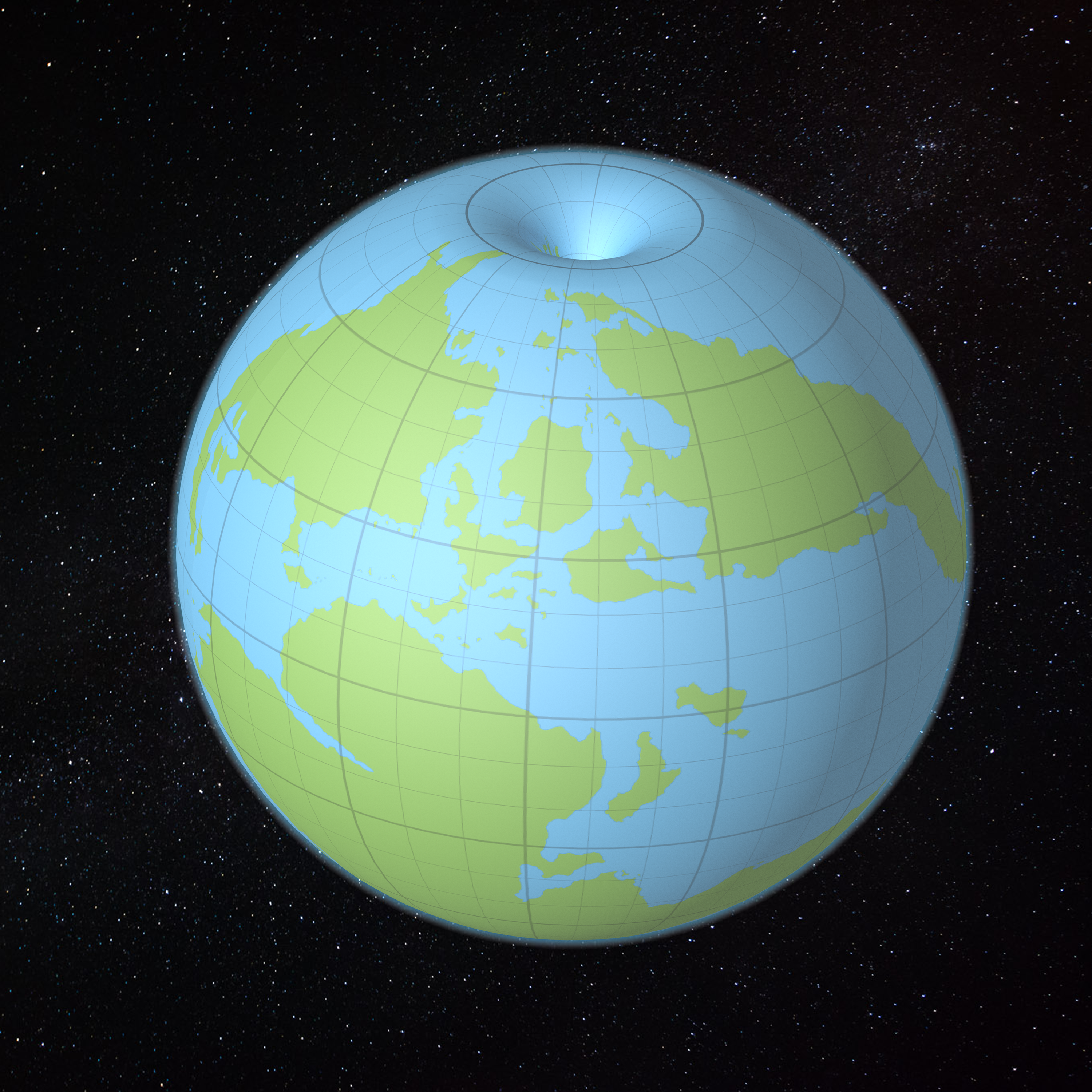
Not bad at all!
I actually cheated and expanded the land somewhat so that it starts to fold into the opening. On my final model, I think I’ll want to make it do so even more. This is going to be a tricky calculation, because how much the land folds over will decide the eventual size of the world.
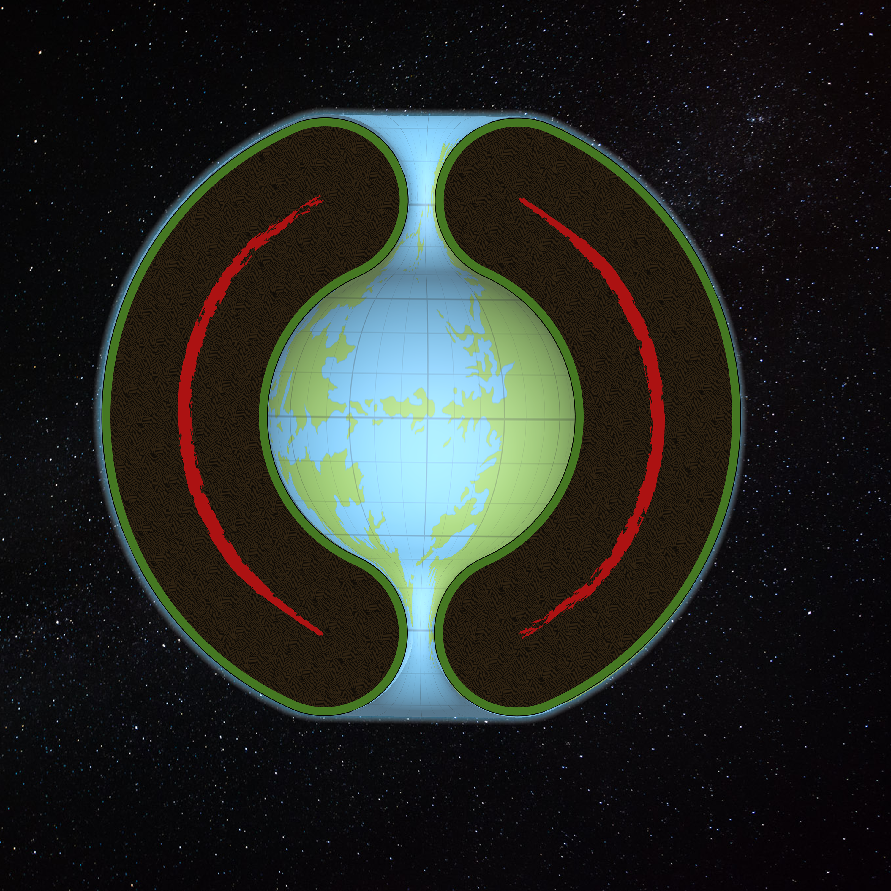
My grid here is a regular square grid, 12 large squares by 12 large squares. Each of these is 30º of latitude, but due to the polar openings this has been thrown off somewhat. We’re going to need to redefine the grid based on where the Outer World/Hollow World split is considered to be. It looks like the last visible line in this picture, just visible before plunging into the Hollow World, may be the best bet.
In any case, let’s leave that sort of thing for another day. This model is not precise. Nor are the maps used to make it. Let’s take a look at it from some other angles.
This is almost the same view as the image above, but with a cross-section applied. You can actually see inside what should be solid rock too, which is a bit confusing. But the Hollow World is right there! That’s Jomphur, Aerical and Suridal.
Here’s a straight-on view, which allowed me to add in the cross-section diagram. It’s a bit of a hack, but you get the picture. Here we can see eastern Iciria on the right, with Aerical and Suridal on the left.
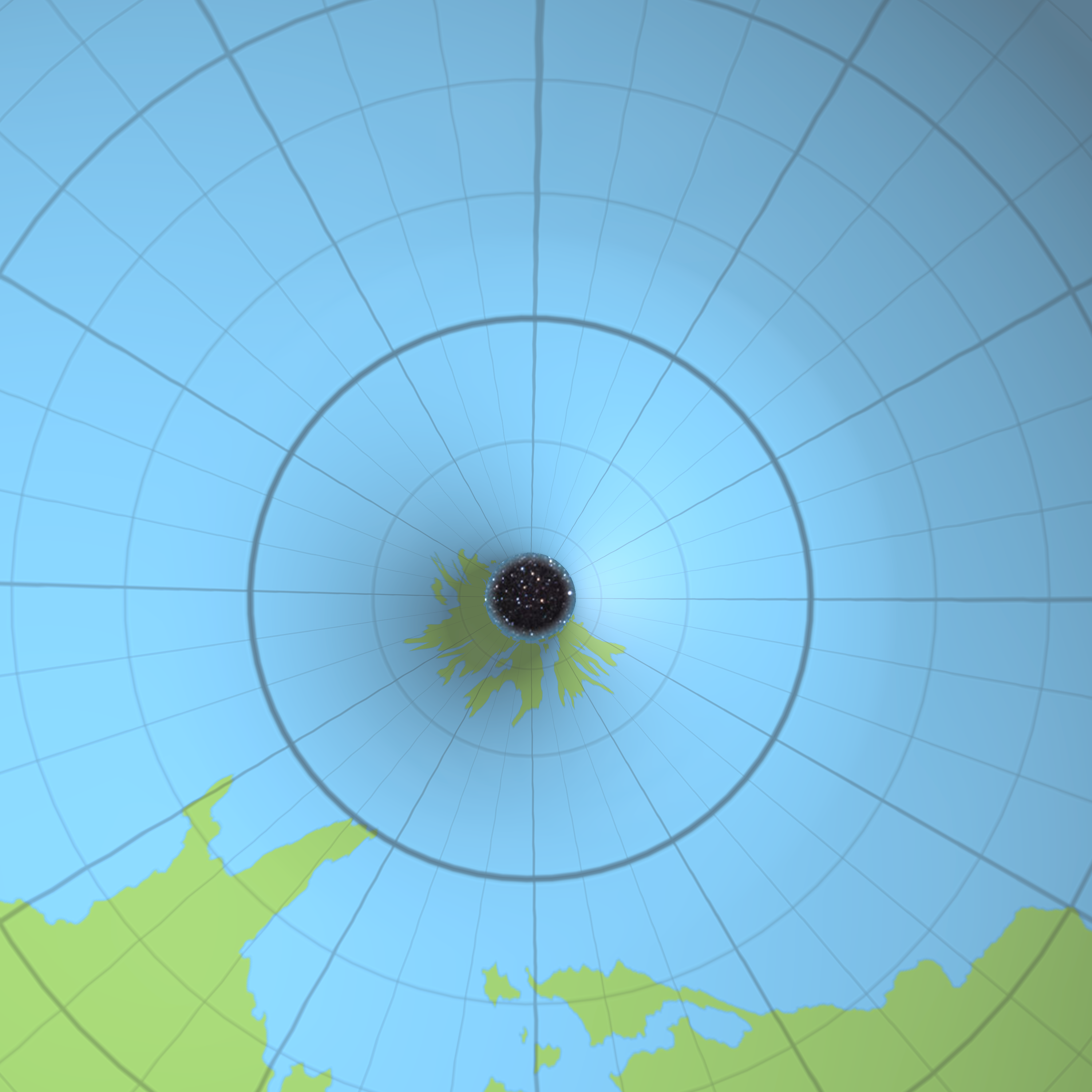
This is a fun one! That’s northern Iciria poking through the opening, with northern Brun at the bottom. Hyborea and Pelatan don’t look nearly so bad on this model as they did on the ellipsoid.
Do you think that Hyborea and Pelatan should be further into the polar opening? I think they should be almost a full small square further in, personally.

Here’s a fun one, with the camera inside the Hollow World looking out. You can see the pinching effect of the south polar opening, although it’s far less than it would be for a south pole proper.
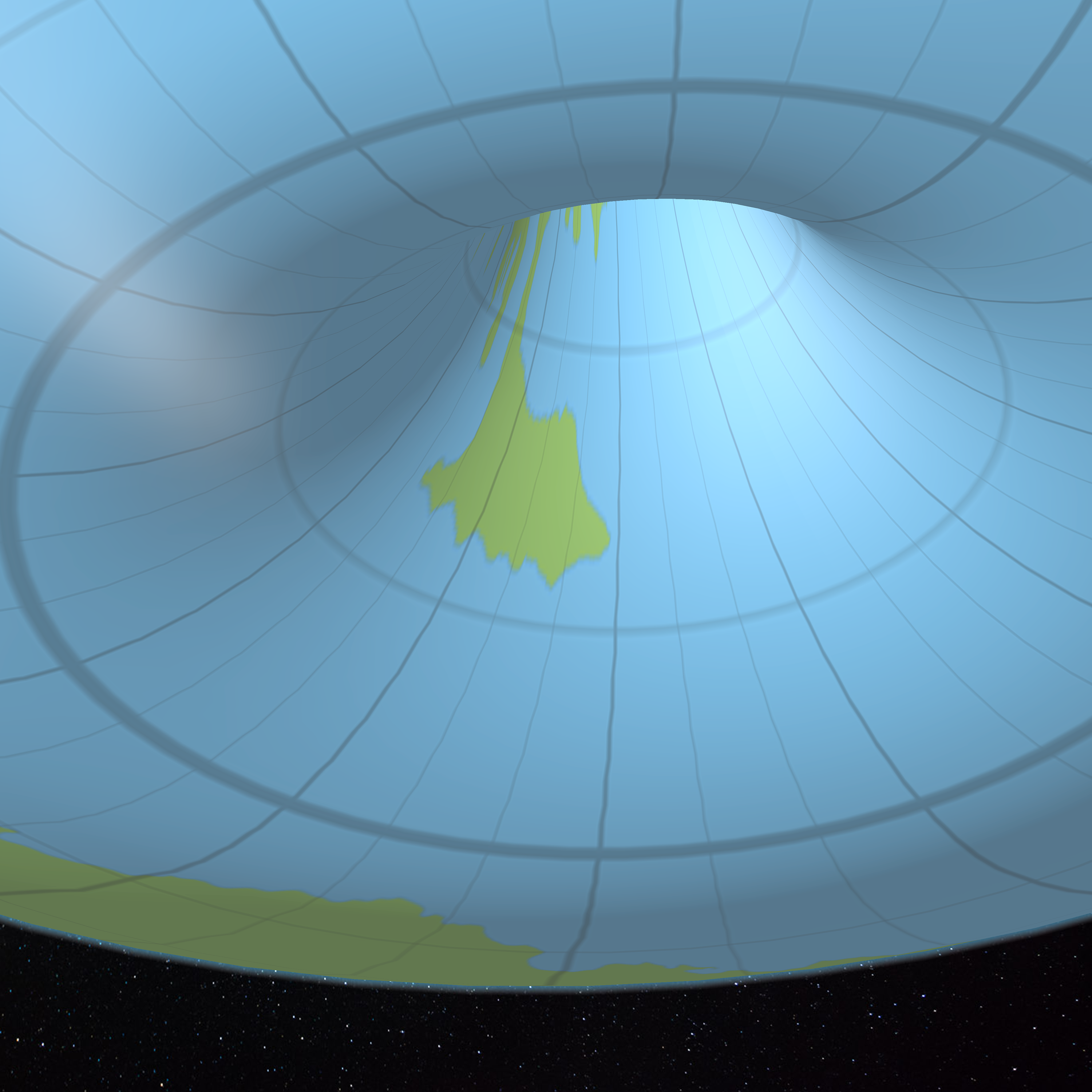
And finally, the Blacklore Elves’ valley, and southern Davania. Again, I think Davania should extend further into the opening.
What a blast! I can’t wait to get to the end of this lining up project, so I can do all this properly with the final model.


22 January 2016 @ 11:56 pm
WOW!
23 January 2016 @ 12:34 am
Fun to see it on a manipulated model.
23 January 2016 @ 1:55 am
Great!
23 January 2016 @ 4:17 am
Wow! Thorf, may I ask what software you are using to make the globe(s) and how you apply the maps to it? My cartography class was so long ago, and was all paper and pencil anyway, but this is simply amazing! Good work! No, great work!!
23 January 2016 @ 3:21 pm
Thanks, Bryan! 🙂
I have another article scheduled for tonight (9pm JST), in which you can see the texture map I made for the model.
It’s all done using Photoshop’s 3D modelling. It may actually be better to do it in something like Blender or Vue, but this is what I’m most used to at this point.
23 January 2016 @ 4:41 am
This is fantastic and amazing work! Well done and presented!
23 January 2016 @ 6:39 am
Grat job, Thorf! I’m especially impressed by the polar opening projection, which does not seem easy to represent at all!
A small remark: the “Pelatan peninsula” is, in truth, the “Nentsun peninsula”.
Finally, I’d be interested on the rationale about the large size of the Farend Ocean. Is it so necessary?
Again, this is really a great work from you, thanks! 🙂
23 January 2016 @ 3:31 pm
Haha! I originally put Pelatan the first time but Nentsun the second time — then couldn’t find the reference map when I was in a hurry to get the article published, and went with the alliteration. 😉 Thanks for catching this, I’ll fix it.
We still don’t have a projection for the polar opening, but at least we now have a texture map. How to present it as a cartographic map is still very much up in the air… I think we’ll never have a perfect projection to do it with, so it will all be reverse-engineered from the texture map, by placing a fine graticule on the texture and working back from there. I think this will allow us to make an elongated rectangular map for each opening — or of course pseudo-projection maps by simply placing the map back on the 3D model, and then labelling that directly.
So it’s still a headache, but there’s light at the end of the tunnel. 😉
For the Far End Ocean… How could we shrink it? If we stretch the Outer World’s continents, the hex maps must also be stretched accordingly. Would we really wish to warp the world like this? And it would need to be pretty severe in order to shrink the ocean; in order to create a narrow Strait of Tangor, everything would need to be almost doubled in the east-west direction, while keeping north-south the same. This is what happened with the Hollow World Set Outer World map.
23 January 2016 @ 7:25 am
I’ve not words if not… AMAZING!!!
23 January 2016 @ 9:28 am
Mega like!
31 January 2016 @ 5:55 pm
Hi
Acording how far in/out the poles;
as far as i remember canonnically.
the distance betweem the most northern tip of brun (Norwold i presume according the story in the Almanacs) and somewhere the northern tip of iceria (the beastman lands) was 41 days of walking on ice, as thus we can use an average walking speed in high snow, ice and wind, darkness and weather, we could assume that 33% is used traversing of the shortest track and back to it.
as thus we reach 27,06 days of walking
12 hours of walking daily should be possible but extremely hard.
as thus the most linear distance was 324,72 hours walking linear
or 19483,2 minutes
or 116899,2 rounds
with movement ranging between 30’/10′ if impeded in any way and no more thsn 90’/30′ in not impeded
the average movement will be 60’/20′
116899,2 x 60’= 7013952 feet total linear distance between the two locations
feet x * 0.00018939=miles = 1328,37236928 miles
that would be the most reasonable distance between the locations.
i hope you can with this assume the correct distance between the two continents.
i think that hyborea most probably stich further in the pole as thus.
let me know what you like (or not) about this calculation,
As far as the great ocean. I seem to remember that the first maps used Zyxl as a reference point for the circumferance. but they named only one side on this map
as the earlier map had way more ocean space i assume they just bended the map to make a globe….
or The unnamed part looking similar to the other side of Zyxl (and on the same level) could be part of another continental group…probably smaller or more islandlike (similar to the Hawaian islands but larger)
As no mystara inhabitants speak about it, it might not exist at all or be thius small and far away nobody was able to reach it or reach the continents known from this.
either way I am not against a larher ocean (with this continental island group) but canon seems to be against it.
nice work btw
very nice
2 February 2016 @ 10:21 am
Thanks, Robin. Sorry about the confusion with your comment — I moderate all comments on this site, so you sometimes have to wait for a while until your comment appears. And sometimes they end up in the spam queue, where it takes me longer to notice them. Unfortunately this is a necessary evil, because there have already been quite a few attempted spams.
Your calculation looks good. Where does the 41 days figure come from? One potential source is the Princess Ark. It’s not going to be anywhere near a reliable calculation from there, but it could be a useful reference.
I haven’t really decided yet how to deal with how much to put in the polar openings, and how much stretching they may need (if any). The easiest way to do it is simply to decide where on the model to place to top and bottom of each map. This will be informed by where on the model the 66º lines fall, because that determines how much land there is to go in the openings. My policy for this is to go with Outer World latitudes based on a graticule overlay of the Master Set map. Everything within 66ºN and 66ºS fits on the globe as it would for a regular globe, as if the poles at 90º really existed. Everything beyond 66º wraps into the polar openings. The Hollow World is just the same in this regard, except that it uses a reprojected version of the Hollow World Set map.
More on this soon!
Regarding the Far End Ocean… The Hollow World Set Outer World map did wrap Zyxl round to the extreme west of the map, but only because it also stretched out the world so much. This is simply not possible without a major rethink of all the hex maps, expanding them all east-west — which would certainly be one way to go, but it’s not the way I want to go.
At this stage, I’d prefer to simply ignore the mistakes of that map, and keep the world as it appears in the Master Set.
Incidentally, I don’t think it’s correct to say that canon “seems to be against” a larger ocean. Sure, various texts suggest contact between Zxyl, Tangor and the Arm of the Immortals, and of course there is the Strait of Zyxl. But there is no way to interpret the maps like that without making Mystara a cylinder — which seems to me to be a far bigger departure than the large ocean.