Let’s Map Mystara 1983
In which we move through the world’s first mega expansion: 1983. Stay with me, it’s going to be a long post!
Mystara Geographic Maps 1981-1983
I’m afraid I still haven’t tackled B3 yet, but it’ll have to wait for another post.

In which we move through the world’s first mega expansion: 1983. Stay with me, it’s going to be a long post!
I’m afraid I still haven’t tackled B3 yet, but it’ll have to wait for another post.

In which we proceed through the rest of 1981’s maps and add 1982’s sole contribution.
From the Atlas of Mystara:
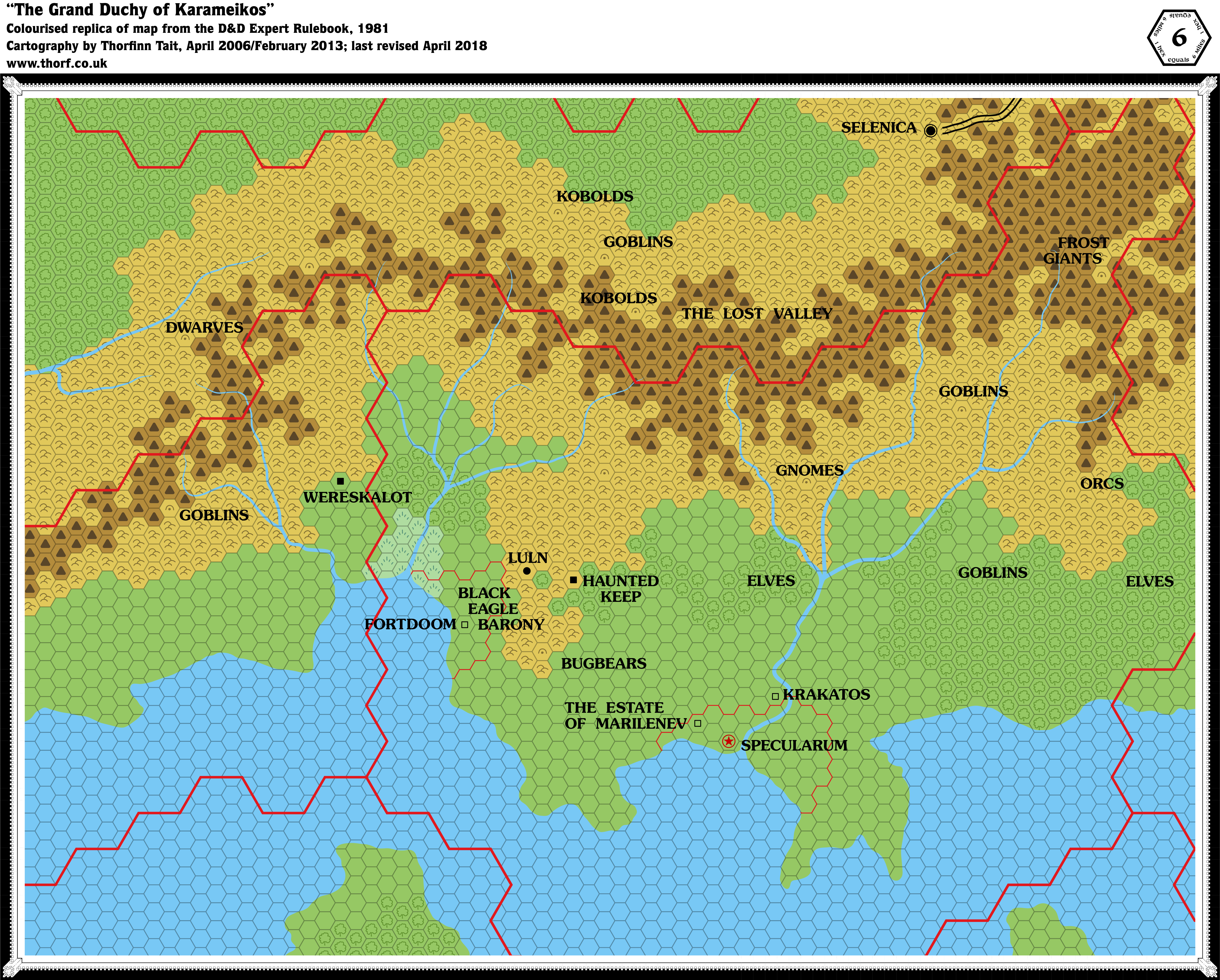
Although the 1981 Expert Set did not reprint the Known World map in any form, it did include a 6 mile per hex map of the Karameikos region. In addition to X1 (1981)’s cities of Specularum and Selenica, this larger scale map introduced a number of new settlements to Karameikos, including Luln (marked as a town); the Haunted Keep and Wereskalot in the neighbouring Five Shires (both ruins); and Fortdoom, Krakatos, and the Estate of Marilenev (all castles). The Black Eagle Barony is named, and labels appear for gnomes, elves, dwarves, kobolds, goblins, orcs, bugbears, and frost giants.
Interestingly, the Lost Valley is shown (though hard to make out) and labelled — and it’s across the border, in Darokin.
The text on page X60 provides some level of detail for some of these names, as well as a few more labels to add to the map: Gulf of Halag and Black Peaks/Cruth Mountains/The Steach.
The text also sets up the Black Eagle Barony and defines its relationship with Luln, and notes that the Haunted Keep is also known as Koriszegy Keep. Amusingly, half of the page is given over to the gnomes, although there is no mention yet of the name of their settlement.

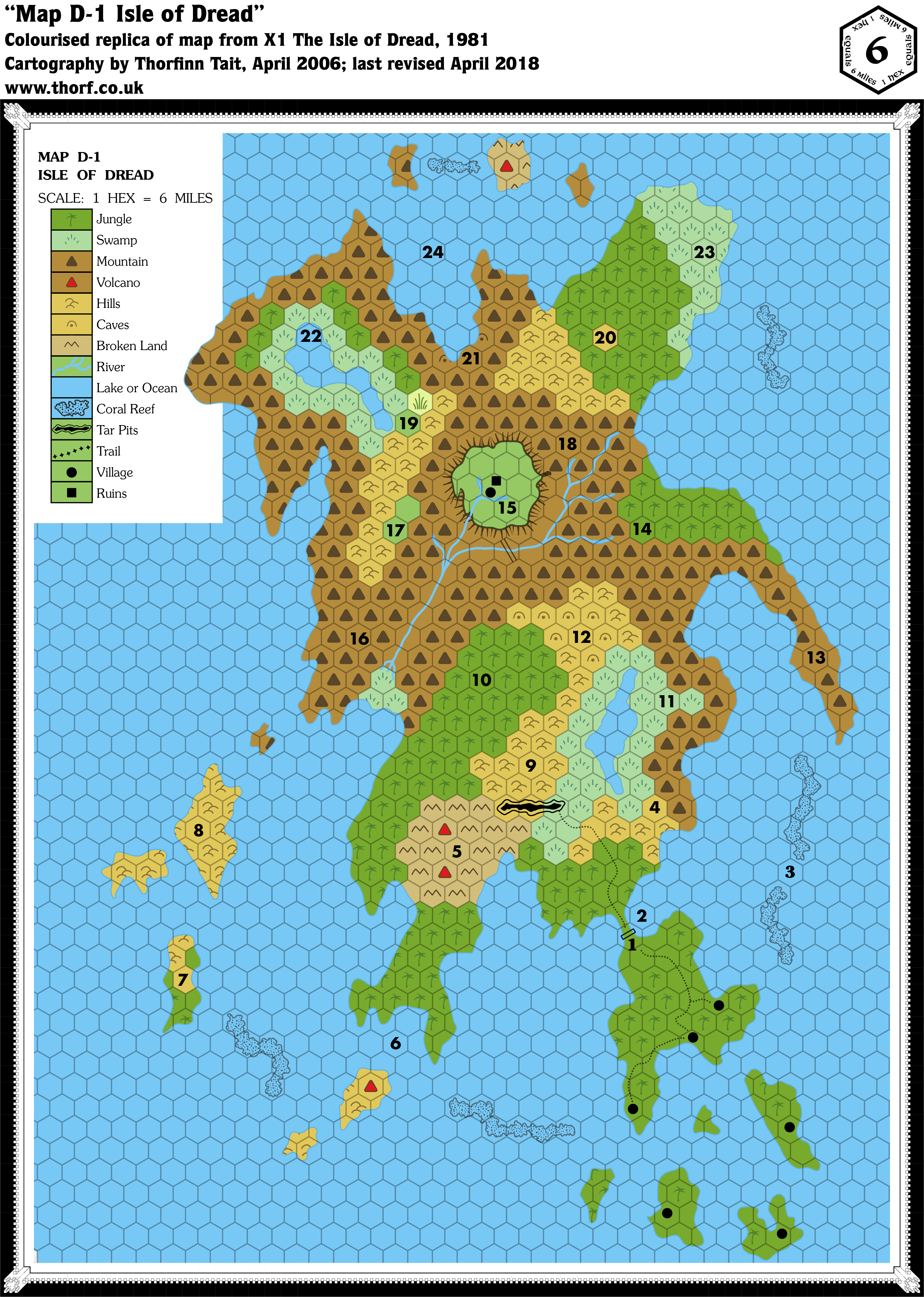
Including Map 2a, the player’s map of the Isle of Dread, which is a variant of this map.
From the Atlas of Mystara:
X1 contains not one but two iconic Mystara maps. This is the original Isle of Dread map.
The map itself used horizontal rather than vertical columns of hexes, but since nothing around it was ever mapped, this doesn’t really pose a great problem. Much more problematic is the scale, and it has become common knowledge in the Mystara community that the map needs to be interpreted as 4 miles per hex in order to get it to match with the size of the Isle as shown on the 24 mile per hex map. The alternative — rescaling the 24 mile per hex map’s Isle to match the 6 mile per hex scale — would put the Isle of Dread out of scale with the other islands in the Thanegioth Archipelago, although it’s an equally valid solution.