
Lining Up Mystara IX
I’ve been working on lining up the world map with what we have so far. This leads naturally into Davania and the problems with latitude, and I think I’m starting to get a handle on all these.
But that’s for another day. Because today I want to share a sneak peek at what else I’ve been working on.
Revised World Map, Take One
In order to do this, I had to piece together a world map. So you can see here my current position thinking on placing Davania and Skothar, and indeed the latitude problem. (Of course it may well still change.)
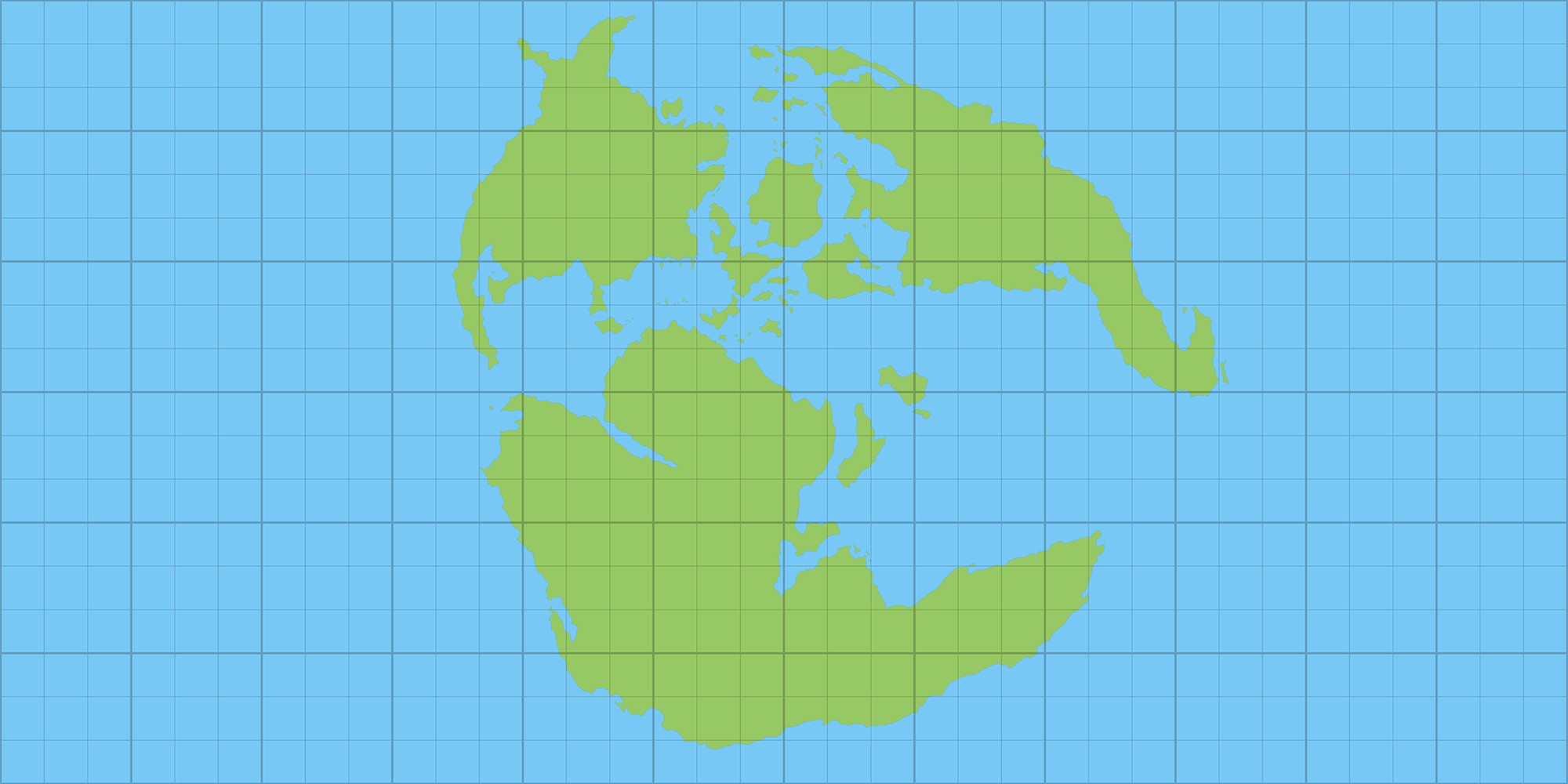
Note how large the Far End Ocean is — and this is not likely to change much. It takes up more than half of the world! Ripe for development…
But let’s get going! Now that we have a 2:1 ratio world map, it’s time to have some fun.
The World of Mystara?
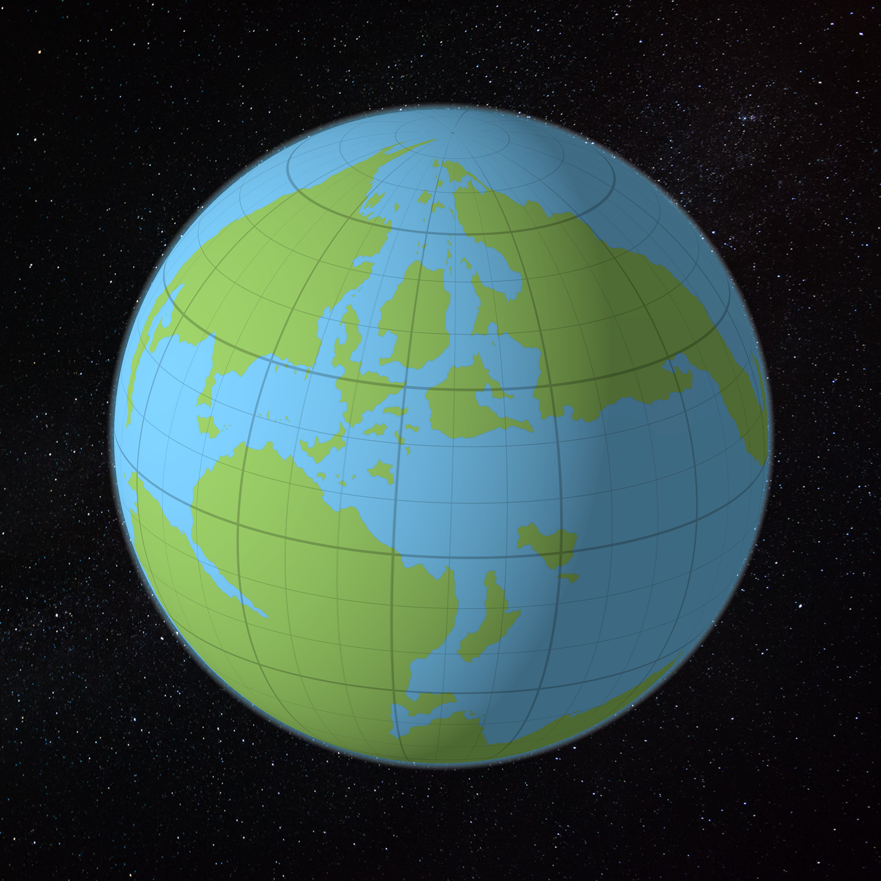
Here’s what happens when you apply the above map to a spheroid. Of course, we all know Mystara is not a simple ellipsoid, so it’s not going to look quite like this, but this is the basic idea.
Do you see the pinching at the north pole? Hyborea is all squashed and tiny, and the Pelatan Peninsula is more of a blob. These can be redrawn slightly to restore their familiar shapes, but their small size is unavoidable.
Thankfully, since Mystara has no poles, the distortion will be rather different from what we see here.
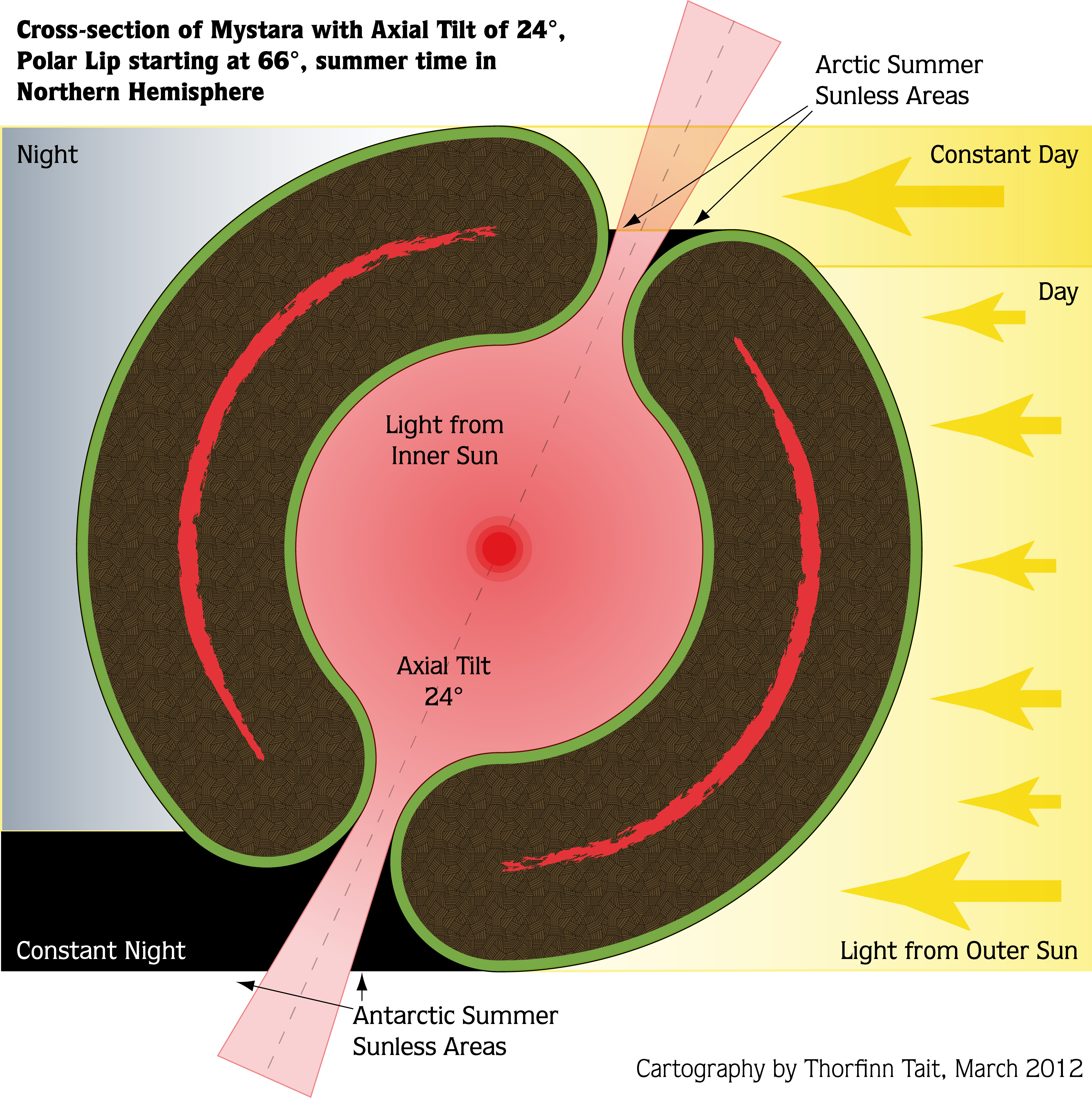
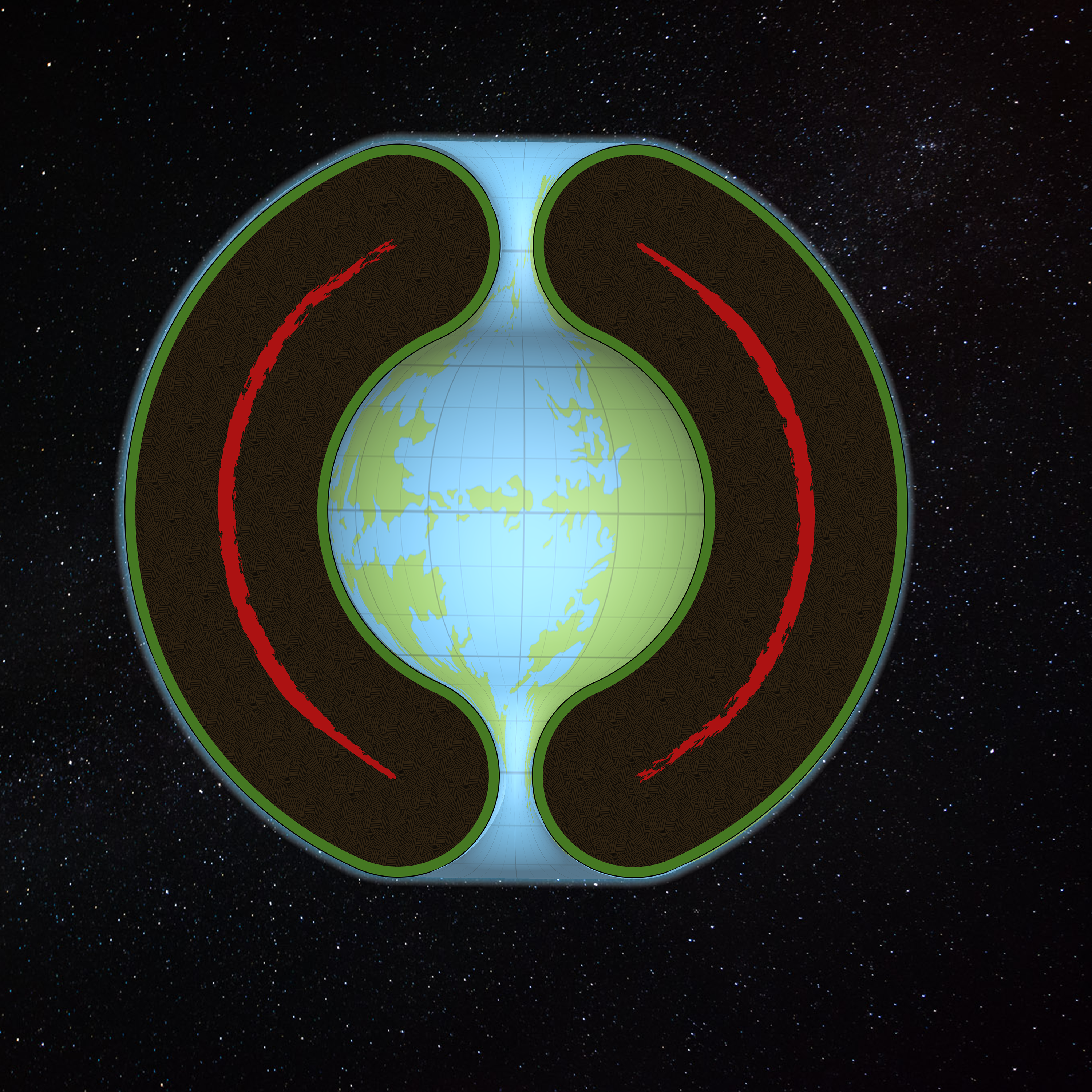
Back in 2012, I created some scale diagrams with my calculated world dimensions of the time. Take a look:

I don’t really remember the exact basis for these measurements, but I will need to revise the Outer World figures when I have everything locked down.
The axial tilt of 24º, combined with the polar openings beginning at the Arctic Circle, 66º, was an arbitrary decision that I’d like to stick with — unless there are any objections. Neither of these were detailed much in official sources; the tropics and Arctic and Antarctic Circles were shown on various maps, but without much consistency.
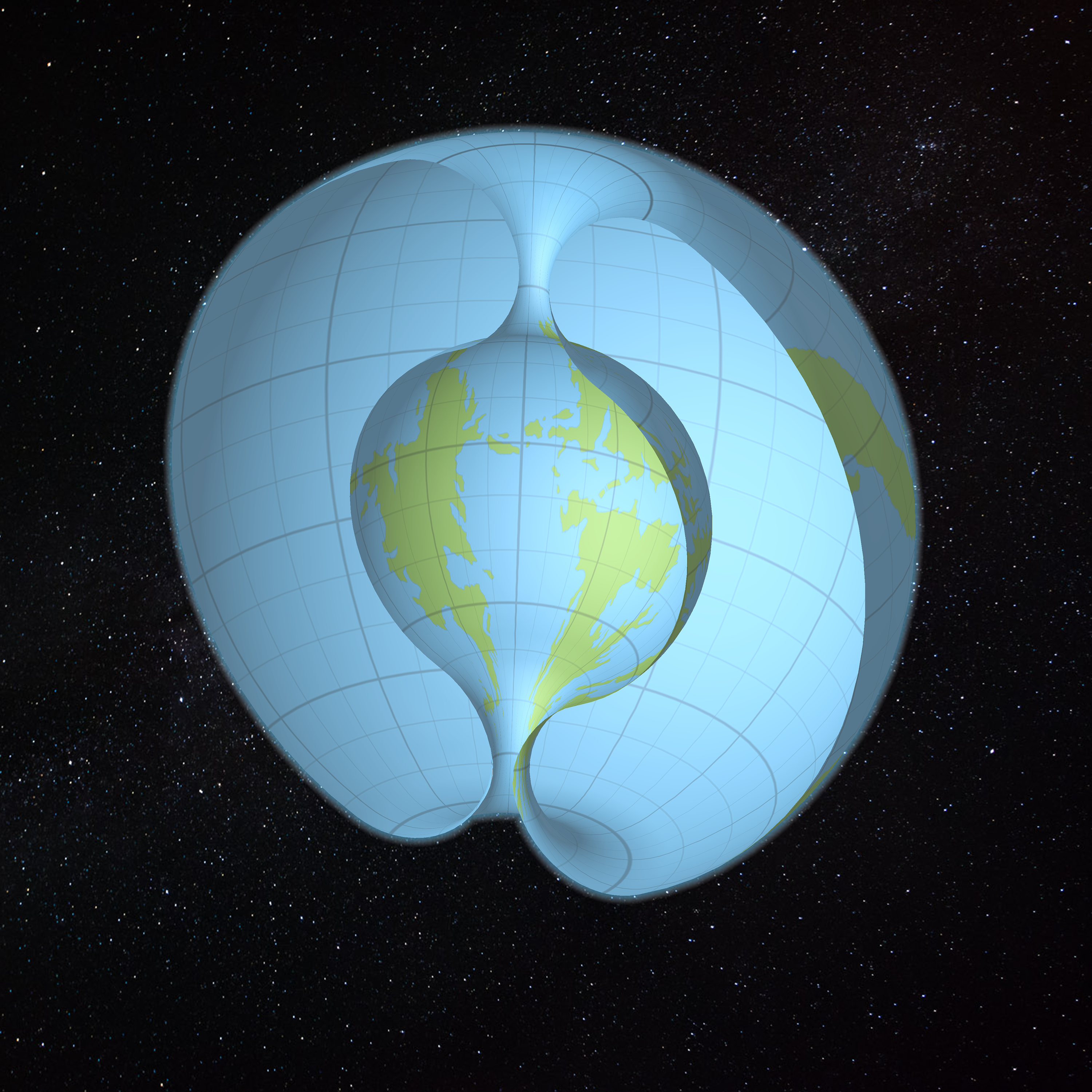
So what would this look like in 3D, with the preliminary world map applied?
The World of Mystara!
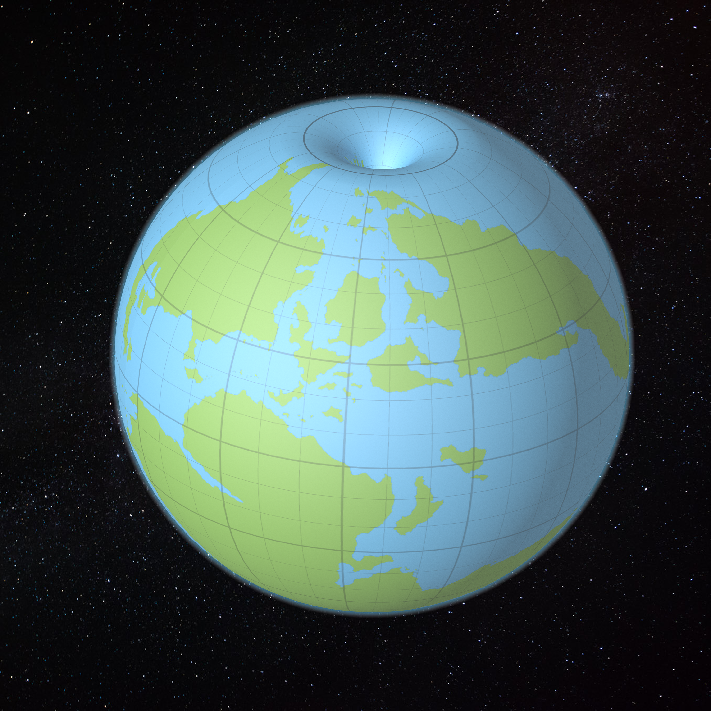
Not bad at all!
I actually cheated and expanded the land somewhat so that it starts to fold into the opening. On my final model, I think I’ll want to make it do so even more. This is going to be a tricky calculation, because how much the land folds over will decide the eventual size of the world.
My grid here is a regular square grid, 12 large squares by 12 large squares. Each of these is 30º of latitude, but due to the polar openings this has been thrown off somewhat. We’re going to need to redefine the grid based on where the Outer World/Hollow World split is considered to be. It looks like the last visible line in this picture, just visible before plunging into the Hollow World, may be the best bet.
In any case, let’s leave that sort of thing for another day. This model is not precise. Nor are the maps used to make it. Let’s take a look at it from some other angles.
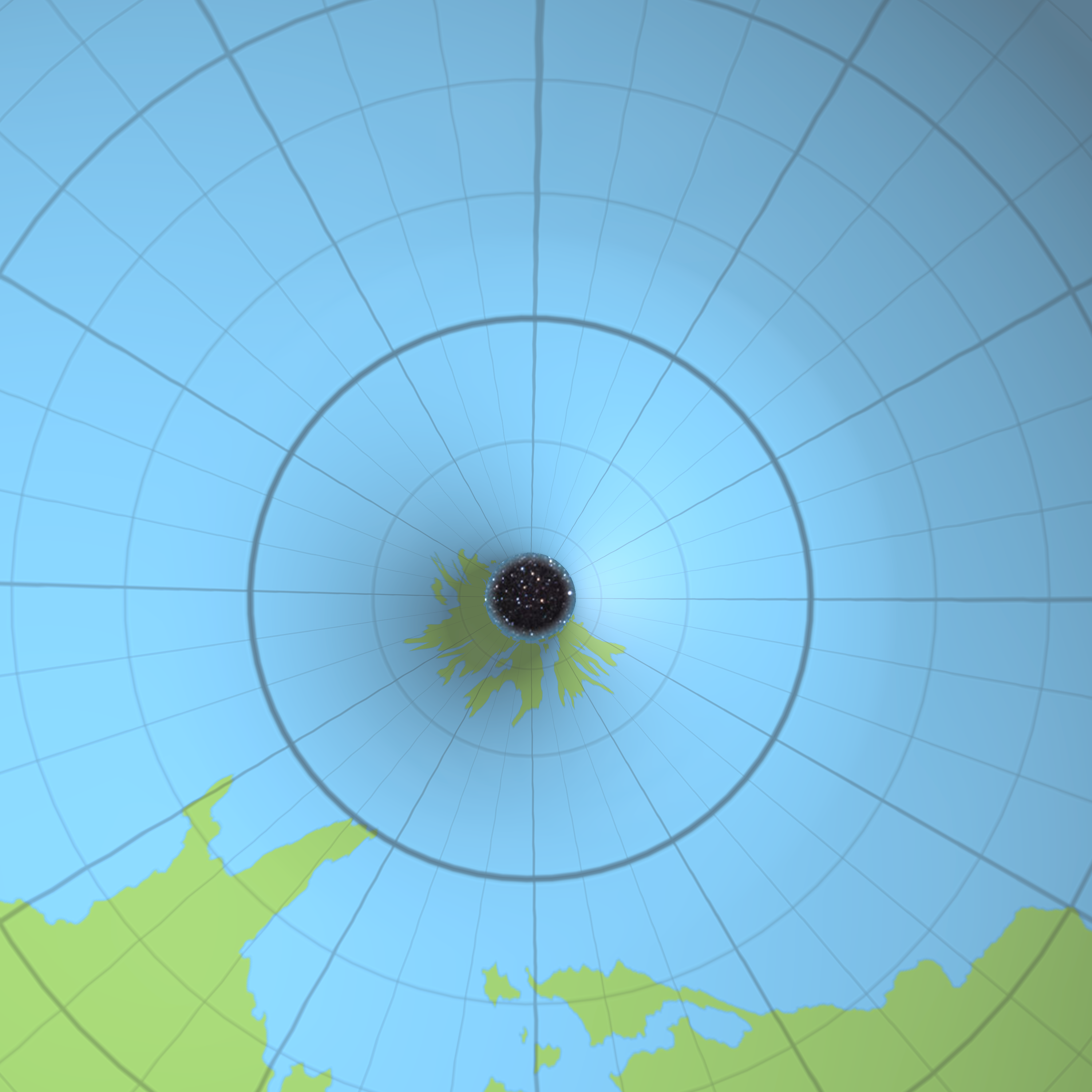
This is almost the same view as the image above, but with a cross-section applied. You can actually see inside what should be solid rock too, which is a bit confusing. But the Hollow World is right there! That’s Jomphur, Aerical and Suridal.
Here’s a straight-on view, which allowed me to add in the cross-section diagram. It’s a bit of a hack, but you get the picture. Here we can see eastern Iciria on the right, with Aerical and Suridal on the left.
This is a fun one! That’s northern Iciria poking through the opening, with northern Brun at the bottom. Hyborea and Pelatan don’t look nearly so bad on this model as they did on the ellipsoid.
Do you think that Hyborea and Pelatan should be further into the polar opening? I think they should be almost a full small square further in, personally.

Here’s a fun one, with the camera inside the Hollow World looking out. You can see the pinching effect of the south polar opening, although it’s far less than it would be for a south pole proper.
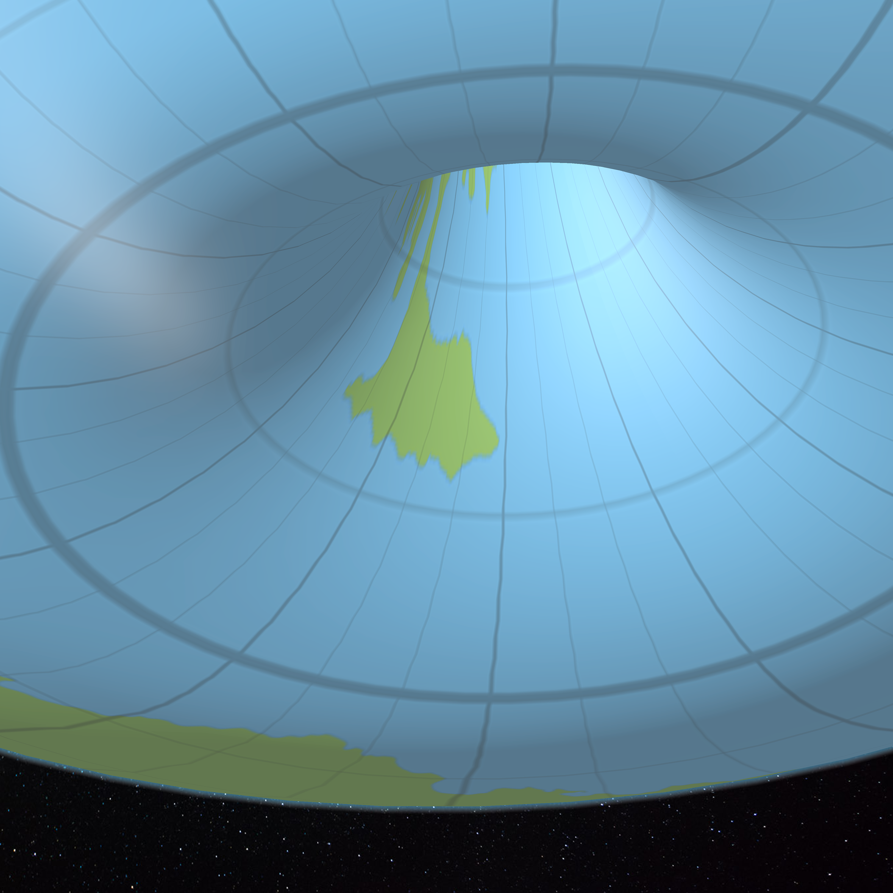
And finally, the Blacklore Elves’ valley, and southern Davania. Again, I think Davania should extend further into the opening.
What a blast! I can’t wait to get to the end of this lining up project, so I can do all this properly with the final model.