
Emirate of Ad-Dhimah Hex Map (Patreon)
This is the second map I’ve produced and published through my Patreon. Many thanks to December’s patrons:
Jesper Andersen, Azure Admiral, Brian Barcus, Trentin Bergeron, David Chart, Francesco Defferrari, Paul Dupuis, Bruce Heard, Brian Isikoff, Grégory Le Louette, Wendy Lord, Harri Mäki, Nate Mangion, Gordon McCormick, Anna B Meyer, Sverre Midthjell, Hervé Musseau, Wolfgang Neckel, Cameron Paine, Thomas Pizard, Dave Poppel, Friedrich Röhrer-Ertl, Robert Slaughter, Erin D Smale, Kurt Stoffer, Sandra Tait, Tom Zunder.
I’d also like to extend my gratitude to Grant Bruce Hewitt for his assistance with the Arabic text, without which I would not have been able to do the Arabic labels. Thanks, Grant!
Now, onto the map itself. This is the first of a series of hex maps covering the Emirates of Narwan. Like the previous map, it’s designed as a two-page spread. The public release file (presented above) is 150 DPI, which is half the 300 DPI of the full resolution map. 200 DPI and 300 DPI versions of the map are available for private use to Patreon patrons.
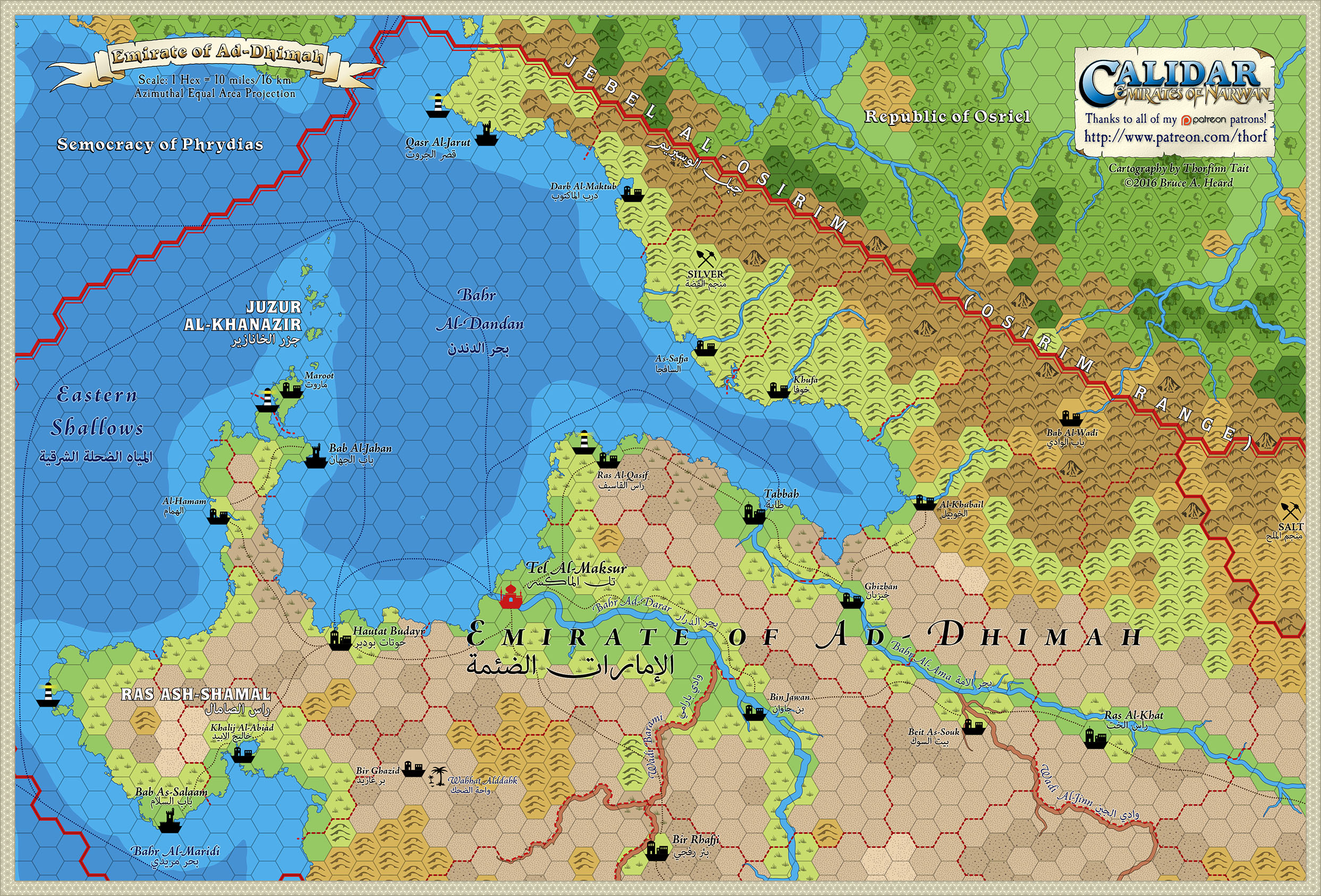
This map covers most of the Emirate of Ad-Dhimah, the political centre of the Emirates of Narwan. Two major rivers, Bahr Ad-Darar and Bahr Al-Ama flow through this emirate. The capital, Tel Al-Maksur, is located at the mouth of the former.
The adjoining parts of the map will appear over the coming months. As always, let me know if you see anything that needs fixed, changed, or added.
Finally, if you like this map, please share it far and wide. Thank you very much!
See also: the first Patreon map, Narwan Topographic Map.